

2020-2023
This period was marked by the COVID-19 pandemic. Greenlebel responded with the launch of the IM Covid-19 Help Center to support the sector as a whole. This support continued with the launch of the IM Resource Portal and its Learning Corner, designed to help organizations improve their data management skills. The involvement in projects related to crisis response, health emergencies, and disaster management remained robust: a responsible data initiative was initiated, while innovative GIS projects for climate change adaptation and COVID-19 vaccine delivery were implemented. In 2022, Greenlebel supported MSF operations in Ukraine with two field missions and developed the FACET WinD tool for Terre des hommes to assess Water, Sanitation and Health (WASH) conditions in detention centers. This period was also marked by the first web development project carried out entirely by a team of volunteers: an interactive map to present SOS Méditerranée’s sea rescue activities.
2016-2019
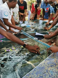
Greenlebel launched the Map Centre for MSF-CH, supported consortia in conflict areas, conducted training workshops, and delved into innovative areas like drone use in humanitarian contexts. In 2017, Greenlebel extended its support to refugee assistance programs and collaborated with various organizations, while 2018 saw the publication of valuable resources such as the MDC Toolkit and the ICT Toolbox. In 2019, Greenlebel forged key partnerships, initiated projects to strengthen Information Management practices within francophone Civil Society Organizations (CSOs), and endorsed the digital development principles, reinforcing its commitment to improving humanitarian efforts through data and technology. After developing a webmapping platform for the Executive Secretariat of the UNAIDS-supported Comité National de Lutte contre le SIDA (CNLS) in Madagascar, a team of volunteers had the opportunity to be deployed in the field to train CNLS staff in using the platform and updating its data.
2011-2015
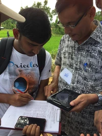
Greenlebel started its partnership with Médecins Sans Frontières Switzerland (MSF-CH), which then led to the creation of the MSF GIS Unit. 2014 was also the year marked by the Ebola crisis, during which Greenlebel supervised more than 18 field missions. On the volunteer side, a Volunteer Emergency Mapping team was created and a first volunteer field mission was organized in Cote d’Ivoire. Another one followed a few years later in Madagascar to support the launch of the Open Street Map community in Madagascar (OSM-Mada). Greenlebel’s contribution to the Missing Maps project started with the first large activation of OSM-HOT contributors by Greenlebel and the first mapathons. Greenlebel implemented also a first large-scale Mobile Data Collection project for Terre des hommes.
2007-2010
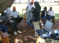
Greenlebel’s first partner was the United Nations High Commissioner for Refugees (UNHCR). It all started with a first Information Management (IM) project in support of the return of Internally Displaced People (IDPs) to Uganda. At that time, Greenlebel focused on Information Management, Geographic Information Systems (GIS) and started Mobile Data Collection in 2010. In 2009, thanks to the work of its volunteers, Greenlebel was able to support the Shelter Cluster following the earthquakes in Indonesia, with the production of useful maps for their work in the field. In parallel, the desire to bring data management issues to the forefront of the humanitarian aid and international development sector, which was already present since Greenlebel’s foundation, gave rise to the first GeOnG forum in 2008.